Archives: Projects

Project Details

Project Name
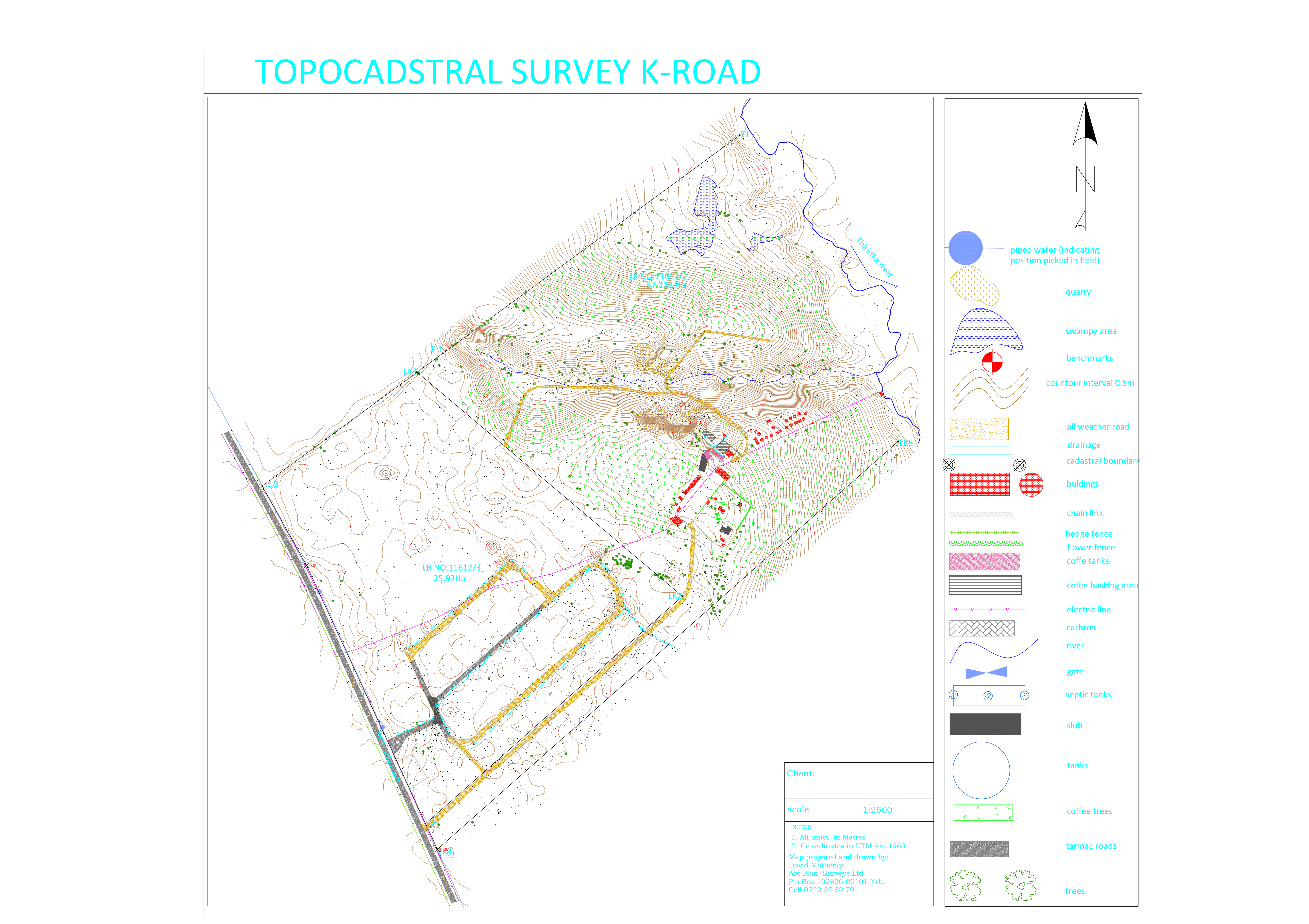
Topocadastral Surveys
Category
Survey
Location
Kenyatta Road, Kiambu

Project Summary

This is a combination of a topographical survey and a cadastral survey .Cadastral surveys are the surveys carried out to support registration of interest in land. They usually result in the preparation of the land registration documents and they conform to different requirements depending on the registration legislation in place. Sample project output along Kenyatta road in Kiambu County  is shown.

Kenyatta Road

Project Details

Project Name
Topographical Surveys
Category
Survey
Location
Gilgil | Marurui | Nazareth

Project Summary

The purpose of a topographical survey is two folds, one is to establish, on a horizontal plane, the position of one or more points in relation to the position of one or more other points. And the other one I to find the elevation (or vertical height) of one or more points above a definite horizontal plane. To do this, one is required you to measure horizontal distances, horizontal angles /directions and height differences. Below are sample outputs of a topographical surveys in various parts of our country.

Gilgil

Marurui

Nazareth

Drawing Model

Project Details

Project Name
Subdivision Survey
Client
Elinjaka Limited
Category
Survey
Location
Olchoro-onyore, Kajiado

Project Summary

Subdivision Survey is the process of splitting a piece of land into smaller parcels. The process involves reparation of subdivision scheme plans, seeking approvals from relevant county Government authorities, execution of the ground survey preparation of survey file or mutation, submission of the survey file /mutation to the director of survey or the district surveyor, issuance of new numbers and amendment of maps and finally registration of the subplots and subsequent issuance of titles for the subplots. The project was in Olchoro /Onyore Registration Section in Kajiado West Sub County. The assignment involved subdivision of an 18 acre piece of land into half acre plots up to title stage.

Olchoro-onyore

Kiserian Subdivision

Land Subdivision

Project Details

Project Name
Master Plan
Category
Consultancy
Location
Langata, Nairobi

Project Summary

The project site was in Langata, Nairobi County. The specific objective was to prepare a comprehensive master plan for a residential neighborhood providing for proper circulation, green spaces, recreation areas, public purpose areas and a commercial zone. The assignment location was close proximity to a flight path and hence the Master plan process had to incorporate civil aviation regulations.

Project Details

Project Name
Engineering Setting Out
Category
Engineering
Location
Miotoni Road, Karen

Project Summary

The project site was off Miotoni Road, Karen in Nairobi County. One of the most important procedures in erecting steel structures, bridges, and precast columns of a building is the accurate placement of the anchorage system in concrete. The specific objective of the assignment was to accurately set out anchorage system in concrete for a set 17 anchoring bolts for a steel structure. The coordinates of each anchor bolt were extracted from CAD drawing and we applied a coordinate method for staking out anchor bolts plate in the correct position using a total station.

Project Details

Project Name
Relocation Action Plan – Mukuru Railway Encroachment
Client
Ministry of Transport
Category
Consultancy
Location
Mukuru

Project Details

Project Name
Relocation Action Plan – Kibera Railway Encroachment
Client
Ministry of Transport
Category
Consultancy
Location
Kibera

Project Details

Project Name
NaMSIP A2 Corridor
Client
Ministry of Lands, Housing and Urban Development
Category
Land Use
Location
A2 Corridor

Project Details

Project Name
NaMSIP Muranga Town
Client
Ministry of Lands, Housing and Urban Development
Category
Urban Development
Location
Muranga Town

Project Details

Project Name
NaMSIP Maragua Town
Client
Ministry of Lands, Housing and Urban Development
Category
Urban Development
Location
Maragua Town